
Franklin County ZIP Coverage
The county geographic ZIP layer contains polygons carrying the postal labels below. The groupings preserve every ZIP found in that inspected layer while keeping like delivery areas together. They show broad service geography, not city boundaries or parcel jurisdiction. The postal-office wording repeats the county layer’s label, not a claim that an address is located inside the corresponding municipality. In particular, the older polygon data gave 43002 and 43126 a value of -99, so their ordinary residential, PO-box-only, or unique status is not asserted here.
| ZIP | Areas covered in county layer | Postal label | Notes |
|---|---|---|---|
| 43002; 43004; 43016; 43017; 43026 | Amlin; Blacklick; Dublin; Dublin; Hilliard | Amlin; Blacklick; Dublin; Dublin; Hilliard | Postal labels only. Verify city or township for a parcel. |
| 43031; 43035; 43054; 43062; 43064; 43065; 43068 | Johnstown; Lewis Center; New Albany; Pataskala; Plain City; Powell; Reynoldsburg | Johnstown; Lewis Center; New Albany; Pataskala; Plain City; Powell; Reynoldsburg | Several have county-edge context that needs a parcel check. |
| 43081; 43082; 43085 | Westerville; Westerville; Columbus postal area | Westerville; Westerville; Columbus | A Columbus postal label is not City of Columbus boundary proof. |
| 43110; 43119; 43123; 43125; 43126; 43136; 43137; 43140; 43146; 43147; 43162 | Canal Winchester; Galloway; Grove City; Groveport; Harrisburg; Lithopolis; Lockbourne; London; Orient; Pickerington; West Jefferson | Same named postal labels | 43126 status is not asserted; edge-area codes need an individual parcel check. |
| 43201; 43202; 43203; 43204; 43205; 43206; 43207; 43209; 43210; 43211; 43212; 43213; 43214; 43215; 43217 | Columbus postal areas | Columbus | Use Auditor city, village, township, and tax-district fields for jurisdiction. |
| 43219; 43220; 43221; 43222; 43223; 43224; 43227; 43228; 43229; 43230; 43231; 43232; 43235; 43240 | Columbus postal areas | Columbus | 43240 is in the geographic map set; confirm an exact delivery address with USPS. |
The county layer is a practical geographic starting point. It is not a current exhaustive USPS delivery list, and it does not classify a code as standard, PO-box-only, or unique. Use an individual USPS lookup and the current county extract before making either statement about a particular address.
Verify Franklin County Delivery ZIPs
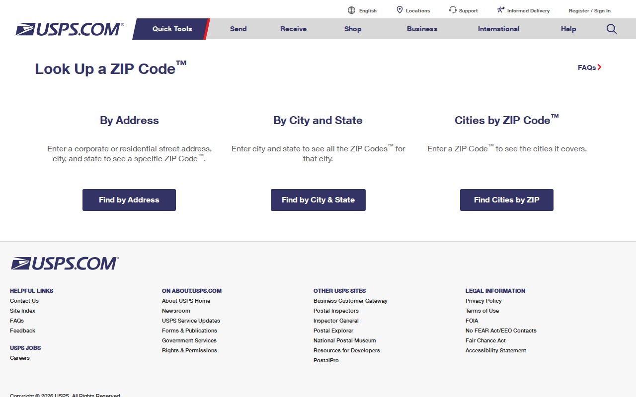
The official USPS lookup is the delivery-verification route for a specific address. It has three distinct forms. By Address verifies a delivery address. By City and State returns ZIPs attached to that postal city. Cities by ZIP Code returns the postal-city information associated with a code. USPS warns that a result does not verify that a particular person or company is at an address. It also notes that address and ZIP updates normally reach the national lookup within 30 to 60 days.
| USPS form | Actual fields | What the result checks |
|---|---|---|
| By Address | Street Address, City, State; optional Company, Apt/Suite/Other, and ZIP | Delivery information for the entered address. |
| By City and State | City and State | ZIPs associated with that postal city. |
| Cities by ZIP Code | ZIP | Postal-city information associated with the entered code. |
The USPS lookup interface appears below. It is the right place to confirm postal delivery detail before comparing the address against county parcel records.
A USPS result settles a delivery question only. It does not identify an owner, prove present residence, or establish a municipal boundary.
Map Franklin County Postal Geography
Franklin County maintains a Zip Codes GIS layer with a ZIPCODE field and a current GIS-shapefile directory. The Auditor map can display ZIP boundaries as an overlay. That combination is useful for planning an area of research, comparing broad postal polygons, and locating a parcel that needs closer review. The map service has USPS-copyrighted postal labels, but a polygon cannot settle the boundary of an individual delivery address or tell whether a parcel lies in a particular municipality.
Start with the ZIP layer, zoom to the area, then identify the individual parcel and open its property detail. The parcel card can provide city, village, township, tax-district, site-address, and parcel information. Those fields are the appropriate follow-up when a Columbus postal label and local jurisdiction appear to diverge. The Auditor Parcel Viewer is a map and property-context tool, with its own primary-source warning.
Note: Treat a ZIP polygon as a broad search frame, then verify the exact delivery and parcel facts through their separate custodians.
Find Records Within a Franklin County Postal Area
A ZIP can help narrow an address question, but the research does not support a claimed ZIP-wide property or resident search in Franklin County. The Auditor’s initial routes are Owner Name, Address, Parcel ID, Subdivision & Condo, Map Search, and Intersection Search. A parcel detail may display a ZIP field as output, yet no verified ZIP filter was found. The Board of Elections form is a precise person lookup, requiring name, birth year, house number, and verification, rather than a ZIP browse tool.
- Use USPS By Address when a full address is available, or use City and State or Cities by ZIP Code to check the postal association.
- Open the county ZIP layer or Parcel Viewer to orient the area, but keep the map boundary separate from municipal jurisdiction.
- Use the Auditor’s Address or Parcel ID route for the specific property. Record the site address, parcel ID, and jurisdictional fields from the result.
- Use Recorder research only after the parcel supplies a party, legal description, subdivision, document, or date lead. The Recorder does not index ordinary street addresses.
- If the question becomes street-specific, use the Franklin County street directory for the address-to-parcel and recorded-document workflow.
Columbus Citizen Access has a ZIP field in its public building-record form, alongside street, parcel, permit, date, and other fields. That does not turn it into a verified ZIP-wide property roll. Within Columbus it can instead help date a permit, certificate, inspection, or address-history record for a known property.
Franklin County Postal Search Limits
The absence of a verified ZIP-wide property filter is an important result, not a gap to be filled with guesses. The Auditor Property Search and Parcel Viewer are strongest when the researcher has an address, parcel ID, owner name, map location, subdivision, or intersection. Recorder Cloud Search is strongest when the researcher has a party, recorded date, document clue, subdivision, or legal description. USPS is strongest for delivery detail. These systems overlap around a property, but their search controls answer different questions.
A claimed ZIP-wide people list would also exceed what the documented sources provide. The person-specific ElectionLink form is not a general ZIP browser. Ohio’s public-voter rules exclude protected information, and Safe at Home protections remain in place. Use a known address or parcel to choose the source, retain the result date, and stop when a record is redacted or outside the custodian’s documented access path.
Franklin County ZIP Boundary Checks
USPS states that ZIP Codes are delivery-unit and carrier-route geography, not municipal boundaries. It does not assign street addresses. Local governments submit newly assigned addresses to USPS. That division explains why a Columbus postal label can accompany a parcel in a different municipality or tax district, and why a property within the county landscape can use a different postal city name. Postal labels change as delivery patterns and boundary-review decisions change.
For a jurisdiction check, use the Auditor property record and Parcel Viewer after USPS has verified the delivery detail. Then use the Recorder’s legal description for the recorded-property question. Do not substitute the mailing ZIP for a legal description, and do not convert the owner mailing address into a situs or residence statement. Each field serves a distinct purpose.
Postal-geography reminder. A Franklin County ZIP describes delivery geography, while the Auditor’s parcel fields identify the local jurisdiction and the Recorder’s legal description identifies the property interest.
ZIP Terms in Franklin County
These short definitions make the Franklin County ZIP code directory useful without granting a delivery field more authority than it has.
- ZIP
- A USPS delivery-area code. It is not a municipal boundary or legal property description.
- ZIP+4
- An added four-digit delivery detail used with a ZIP. It refines mail routing but does not identify a person.
- PO-box ZIP
- A postal code associated with post-office boxes. The inspected county layer does not establish which Franklin County codes have that status.
- Unique ZIP
- A code used for a single organization or large recipient. The inspected county layer does not establish that status for a listed code.
- Carrier route
- A postal delivery route. USPS designs ZIP geography around delivery units and routes rather than city limits.
The three property fields need equal care. A situs address locates the parcel, an owner mailing address directs correspondence, and a legal description identifies the recorded land interest. A ZIP may appear near those details without replacing any of them.
Franklin County Postal Address Authority
Address verification has another local boundary. Inside Columbus, BZS GIS assigns certified addresses and street names under City Code Chapter 907. It can investigate an apparent City-system mismatch caused by a historic recording error or unapproved numbering, and BZS Records offers an Address History request for a certified property address. That authority is city-specific. It does not automatically govern properties in every other Franklin County municipality or township.
For an address outside Columbus, begin with the relevant municipality or township and use the Auditor and Recorder to confirm county parcel and legal-property facts. For an address inside Columbus that needs postal verification, check USPS delivery detail separately. This division of work directs a searcher to the correct geography before the property-record search begins.
Note: A postal result, a city-certified address, and a parcel legal description can all be accurate while describing different aspects of the same location.
Franklin County ZIP Evidence
The useful sequence is postal delivery confirmation, map orientation, parcel verification, and recorded-document research if the question requires it. That sequence also guards against a common geography mistake: assuming a ZIP or postal city label determines municipal responsibility, tax district, owner status, or current residence. It does not. The county’s records keep those facts in separate fields and systems for good reason.
For an old or changed address inside Columbus, BZS address-history research, the Library’s street directories and maps, and the Recorder’s legal-description chain can explain the difference in a dated way. For a current address, use the current USPS lookup and Auditor record. Each result should carry its source and date so the next step remains verifiable.